|
|
|
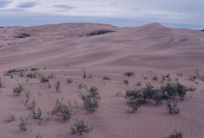
Hydrology, Biomass and Climate The idea behind our first expedition to the Great Sand Hills of Saskatchewan was to gather preliminary evidence for measuring the rate of increasing movement among the dunes and survey what seems to be a decline in vegetation in the hope of understanding further the climactic changes in the north west. Toward this end we chose seven of the largest and most active dunes along with two nearby inactive which still had some vegetation on top and through triangulation positioned each on a grid (twenty- one dunes in total). On top these dunes we buried a small piece of metal (perforated strapping) for verification- later- and established locations for each with a g.p.s. finder. Then on the top of inactive dunes a square meter was demarcated by wire and all growth identified, enumerated and catalogued. Samples were also taken of each specimen identified along with soil samples for the measuring of moisture content and other analysis. In addition, the declivity (lowest point at the bottom of each active dune) was identified and the distance to the apex measured. All flora and fauna in the immediate area was noted and our initial observations yielded some dramatic insights. Most shrubs and bushes especially the willows, the birch and the poplar or aspen groves were obviously either dying off or severely stressed. The most notable decline however was in the matting of creeping juniper which had seemed to stabilize the entire area and to a lesser extent in the growth of sage itself. All data will be published on this website at the conclusion of the study. |
|
|
|
Initially the study was planned as a three year project with a repeat of the above data collection over three consecutive summers. However, circumstances did not seem favorable in the spring of 2003 for an unusual amount of moisture and some snow late in the spring was considered an anomaly and thought perhaps to skew the study. So we did not return and this may have been an error for later toward the onset of August it proved to be one of the hottest and driest summers on record. Now we are planning for the collection of data in the summers of 2004 and 2006 to balance the picture. |
|
|
|
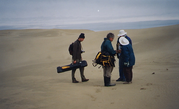
Research crew on preliminary survey, summer of 2002. Analyzing and recording data in camp.
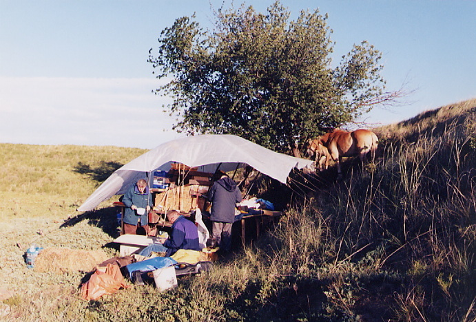
Restricted area allows no motorized vehicular access. Research teams work and live off covered wagon.
Hopefully, data can be compared to the rate of loss in permafrost along the Mackenzie Delta , in ice receding among the glaciers , as well as in other examples of dramatic changes related to warming and drying trends in The Kazan, the Athabasca Delta and the Athabasca Sands. Areas such as these in the greater northwest reveal immediate and dramatic changes at even small deviations from mean rainfall and temperature levels.
Guests may accompany an expedition and participate in the collection of data but should inform the lodge at least six months in advance. It is fascinating work especially for those with an interest in geology or archeology. Most of these regions are inaccessible except by air. |